Better Map for Melbourne
Victorian Rail Map 2027-2028 (proposed)
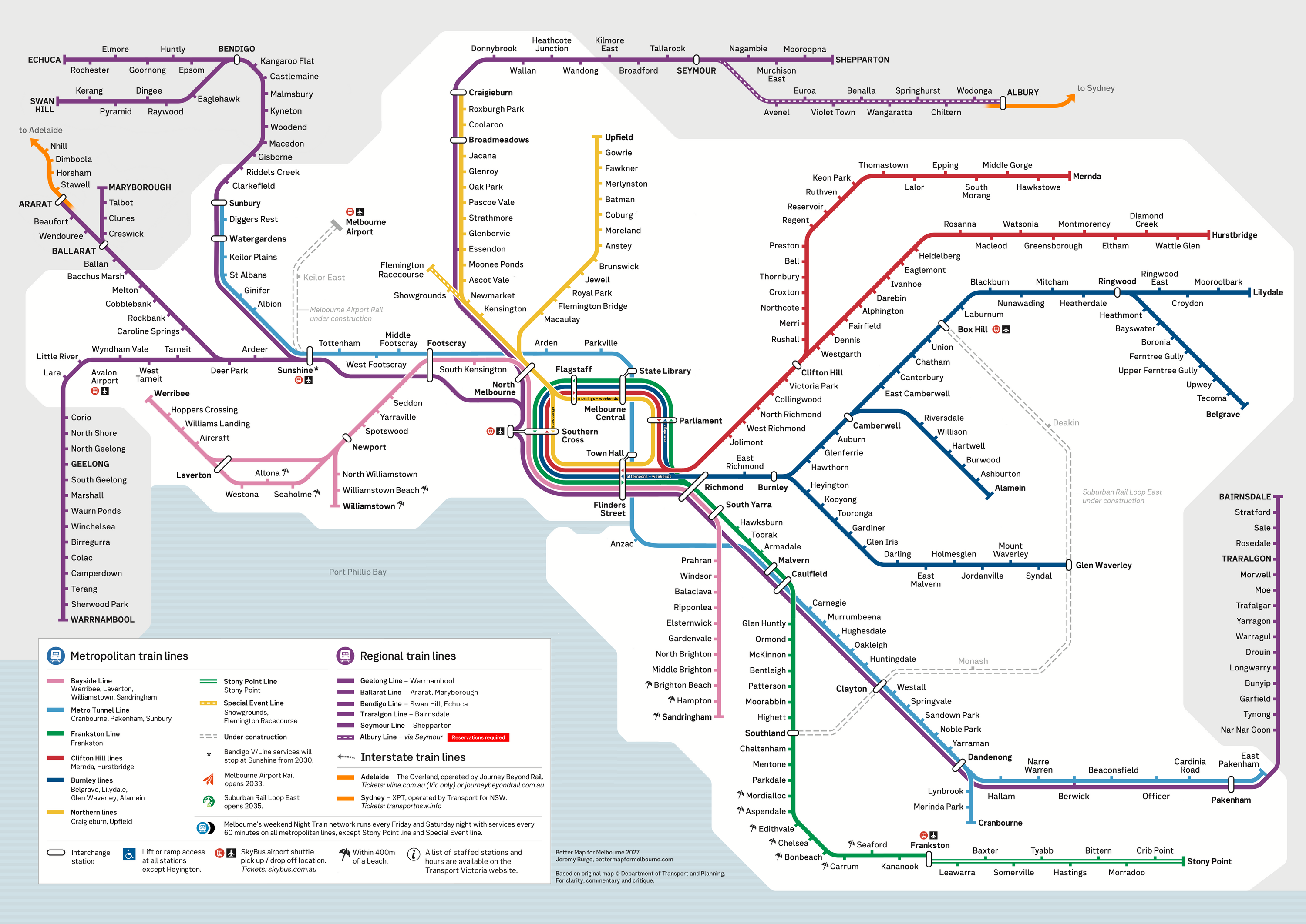
Proposed map by Jeremy Burge, based on official map © Department Transport and Planning. Shows services as currently planned and under construction. View high resolution PNG.
Victorian Rail Map 2026 (official)
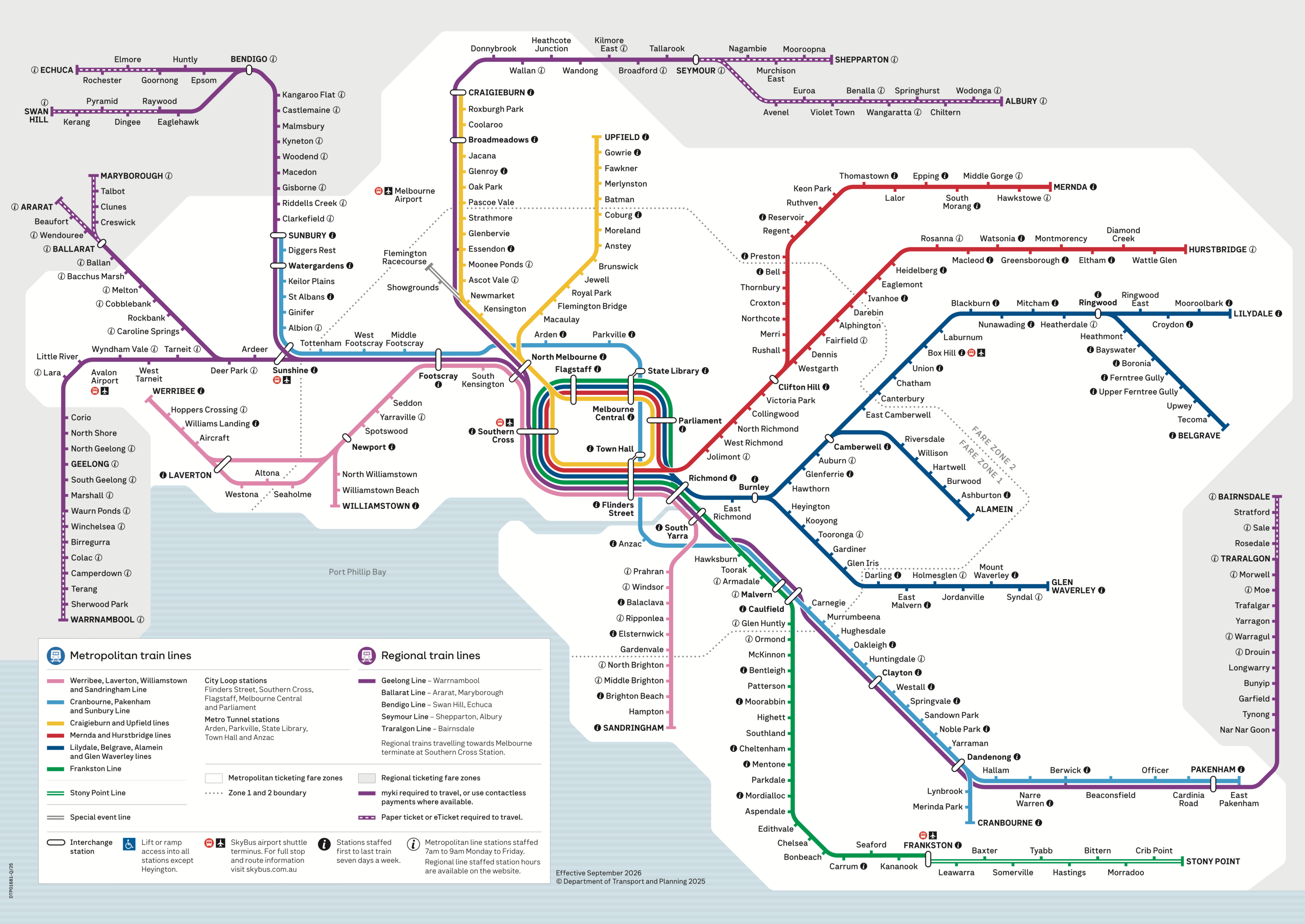
© Department Transport and Planning. Effective September 2026. View high resolution PNG.
Compare
Details
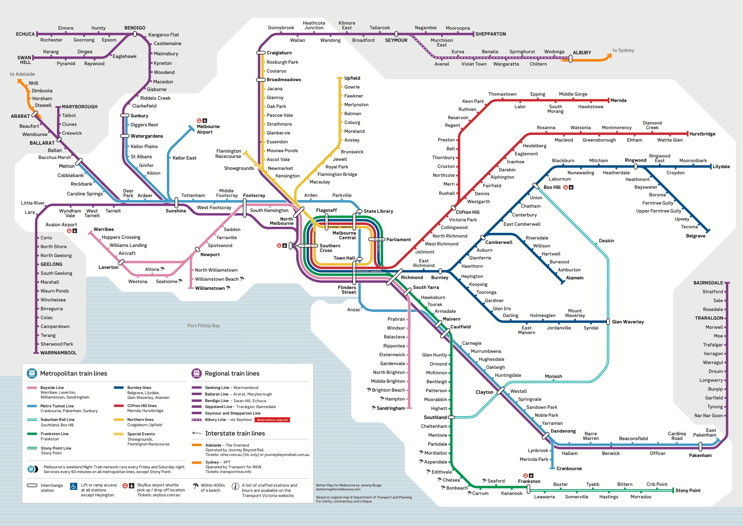
North Melbourne
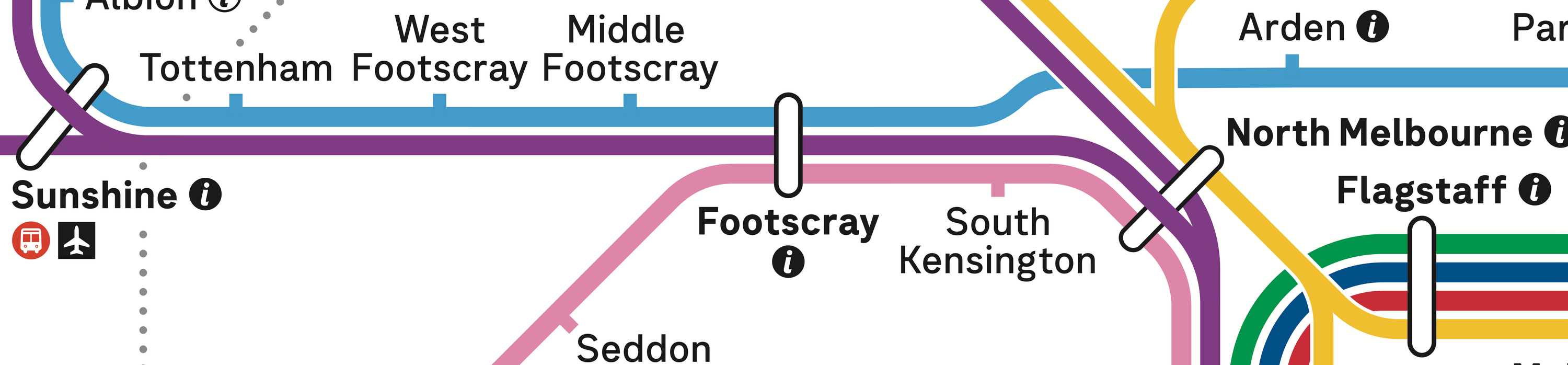
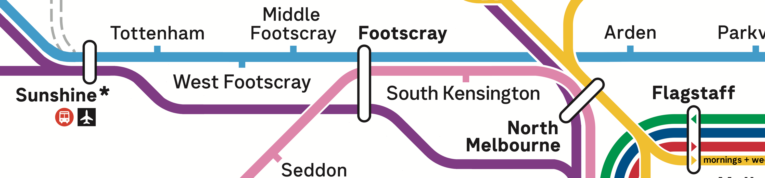
The challenge: All V/Line lines use the same shade of purple, which makes for an unappealing design when they run in parallel such as the approach to North Melbourne. This is further complicated by Bendigo and Ballarat Line trains skipping North Melbourne, which shows as the line running through / over the top of the station interchange lozenge. The Metro Tunnel Line shows a kink for no apparent reason between Footscray and Arden.
South Yarra
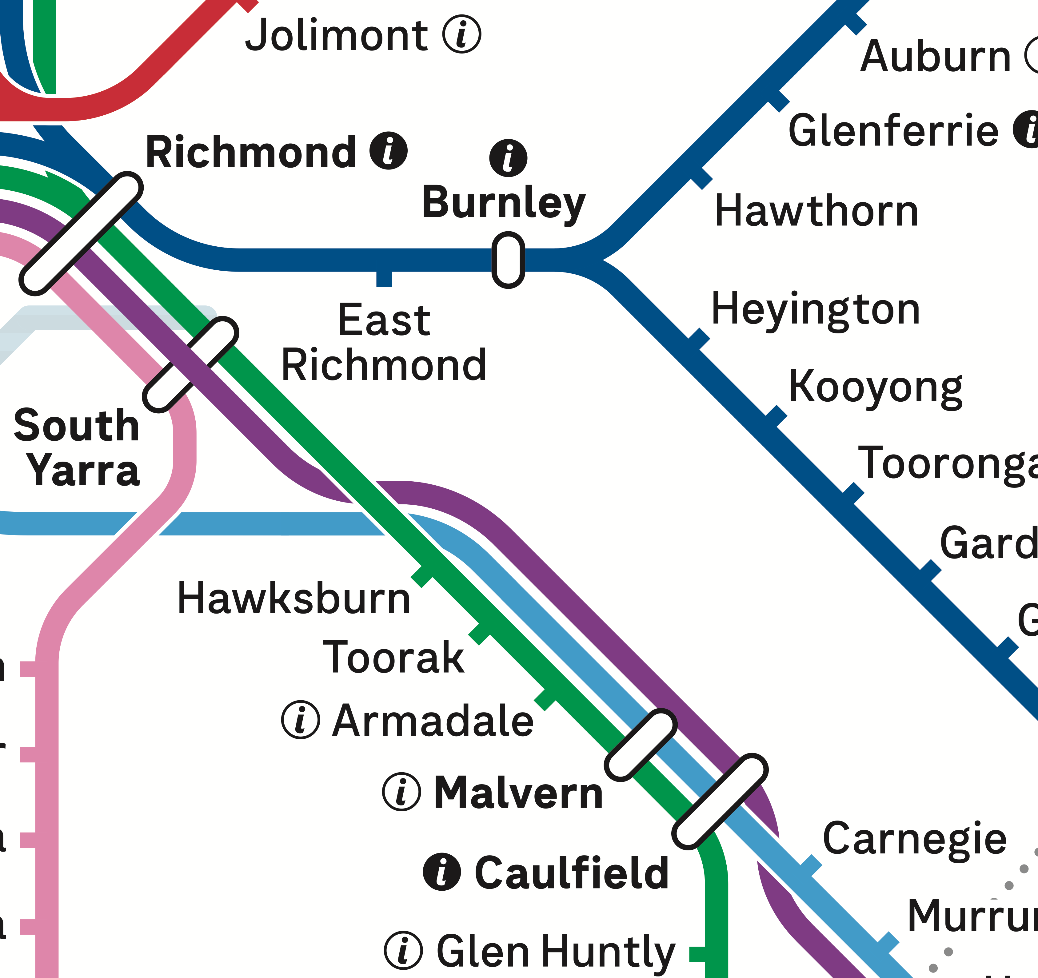
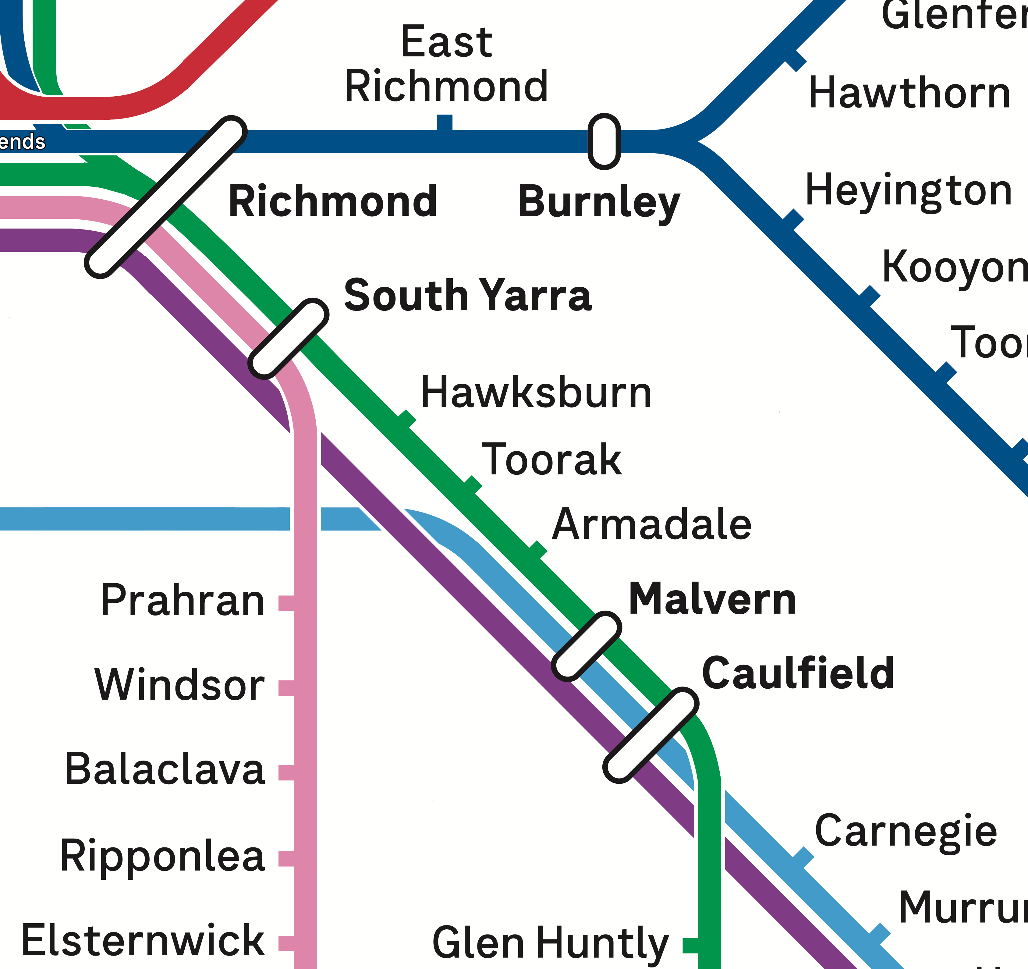
The challenge: Gippsland Line is forced to curve twice, to accommodate station labels and other lines between Carnegie and South Yarra. South Yarra has the Gippsland Line running express through the station, but as it's the centre line on this map, it is forced to show an ugly compromise of running over the interchange lozenge.
Airport
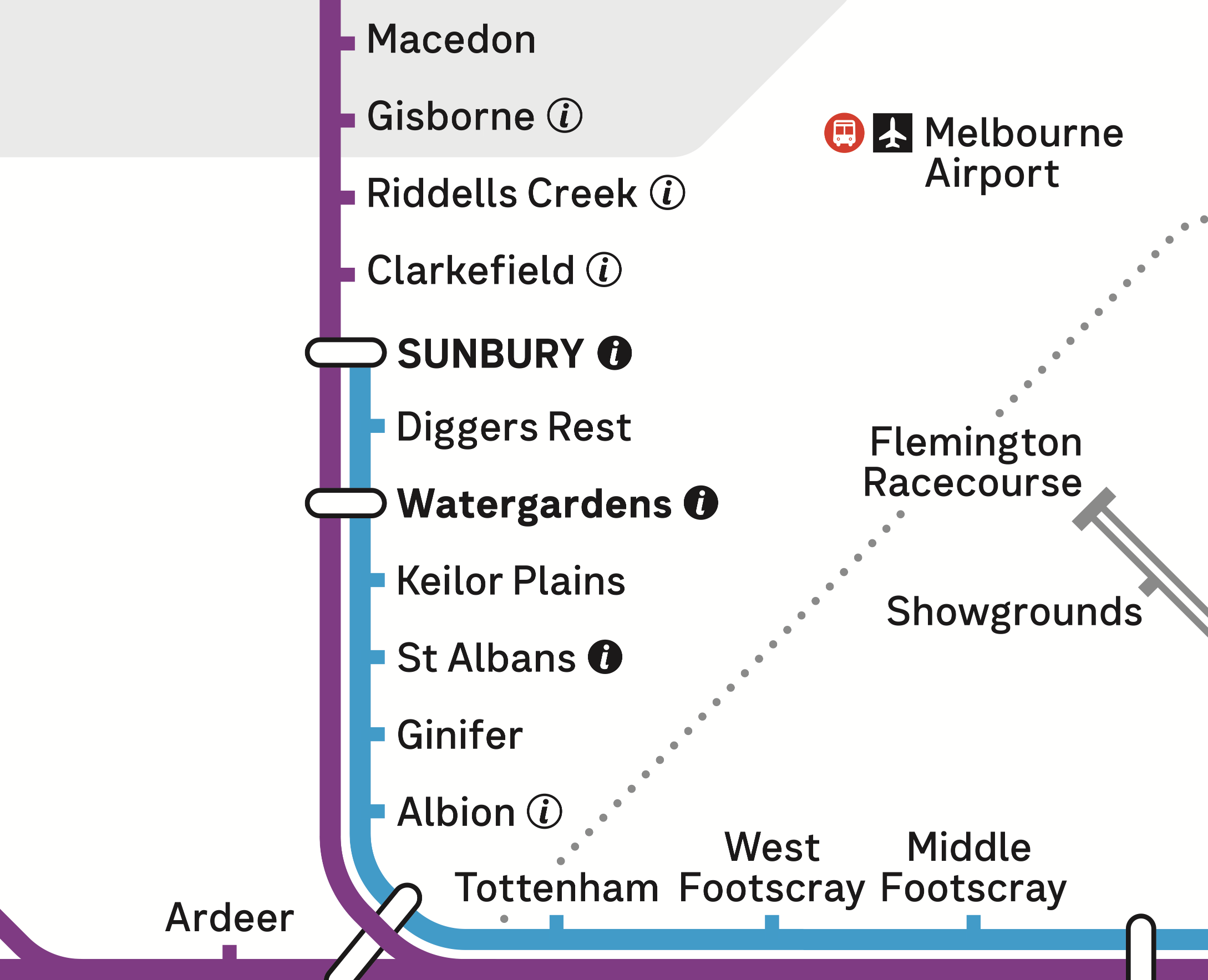
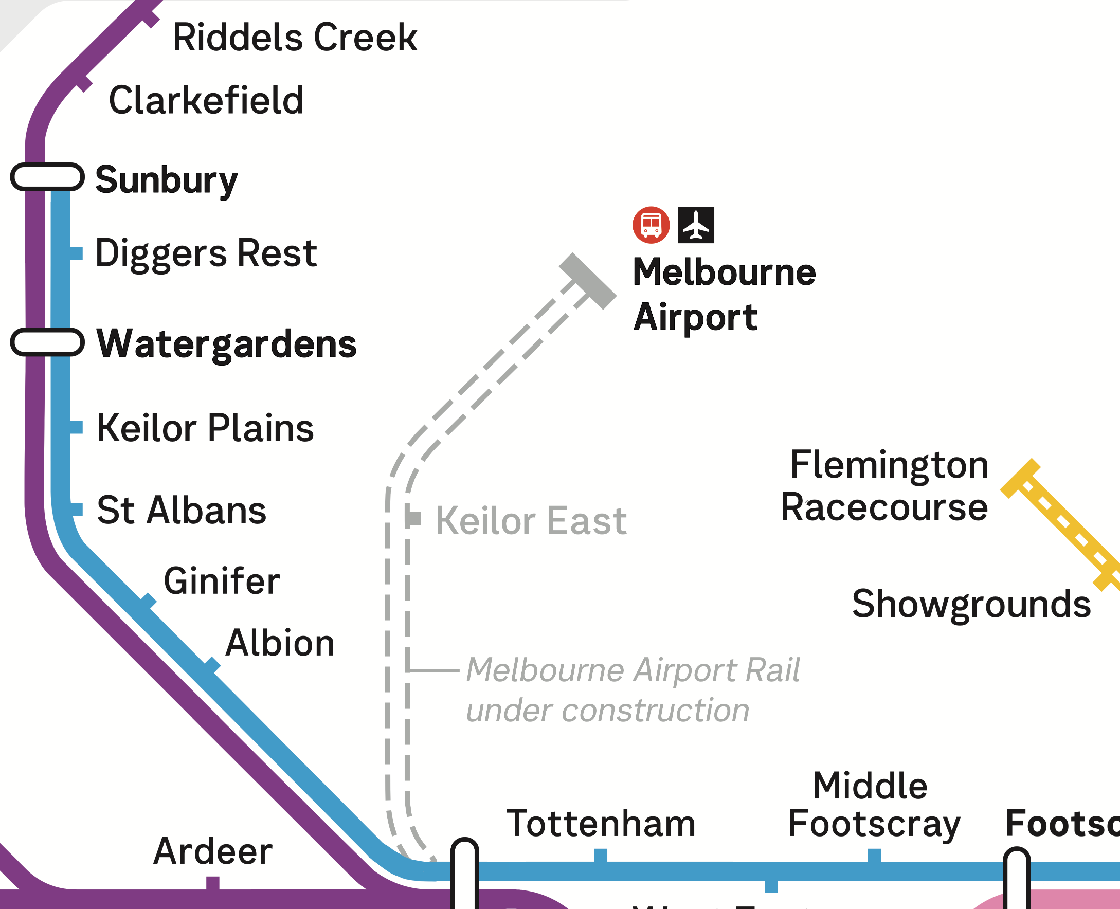
The challenge: Making space for the Airport Line to cleanly fit in the crowded western section of the map. The location of Melbourne Airport SkyBus terminus is shown quite far north, with the Special Event Line and the Fare Zone Boundary both impeding clear space to show the future Melbourne Airport Rail Link.
Southern Cross

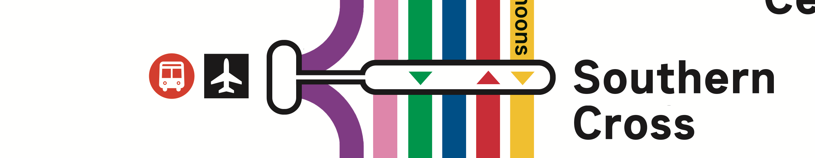
The challenge: V/Line services all terminate at Southern Cross, but there is limited space to make this clear. Hence the small curve to the side that the purple lines show when they reach SoCro. Also due to the way V/Line is shown in the North-West and South-East, the line approaches Southern Cross wedged between the Bayside metro line and Frankston metro line.
City Loop
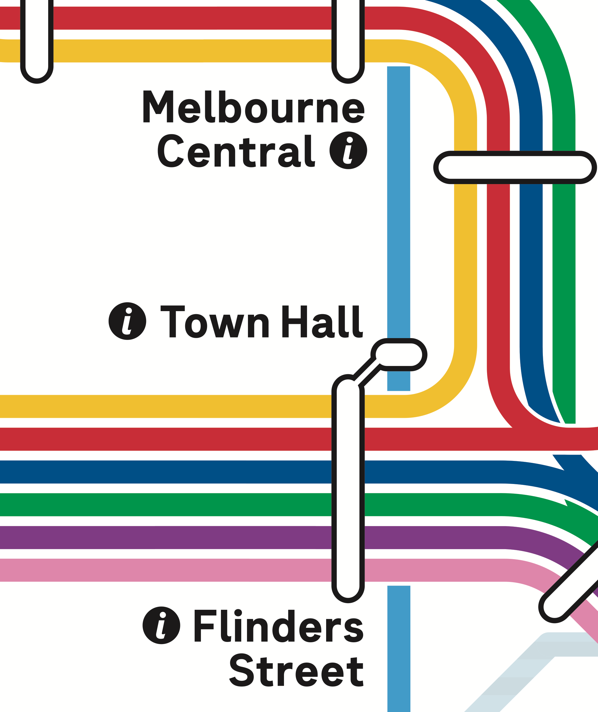
The challenge: There is no way to determine which way any of the lines go around the City Loop. This is complicated by the fact that two of the four lines change direction in the middle of the day.
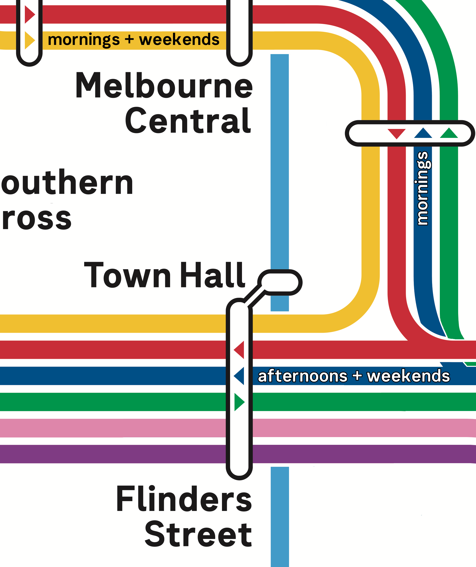
Suburban Rail Loop
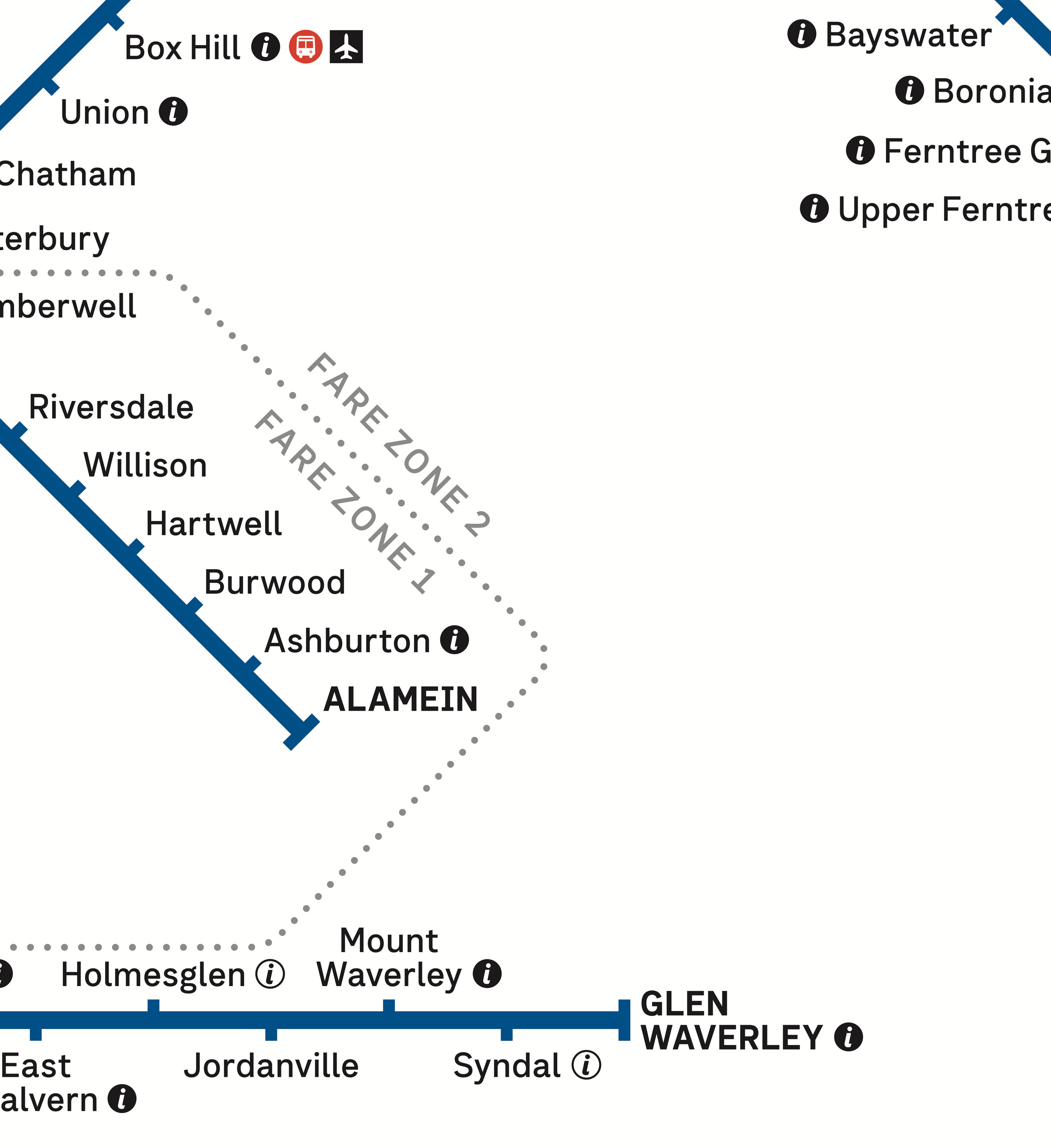
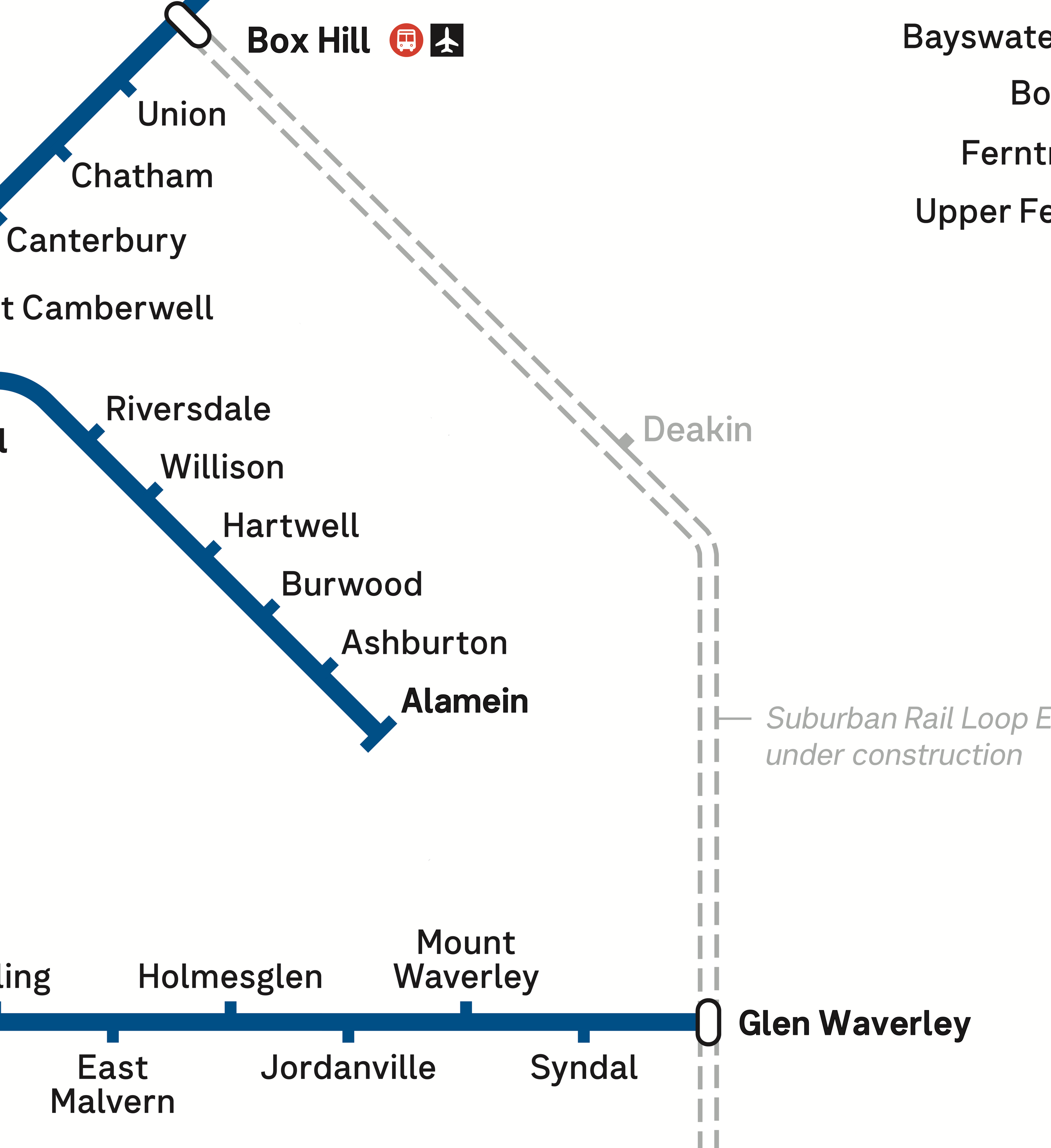
The challenge: The fare zone boundary between zone 1 and 2 sits in a similar section of map to where the Suburban Rail Loop East will run.
Flemington

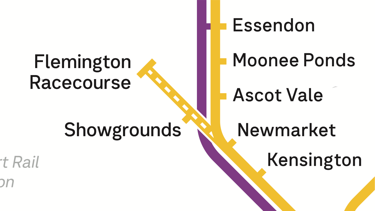
The challenge: Showing this line on the map yet making it clear the service is part time only. The current map shows this in grey and white, which does make it stand out from other lines nearby. What's difficult to convey is the fact that some services are direct between Southern Cross and Showgrounds and/or Flemington Racecourse, while others originate at Flinders Street
Paper Tickets
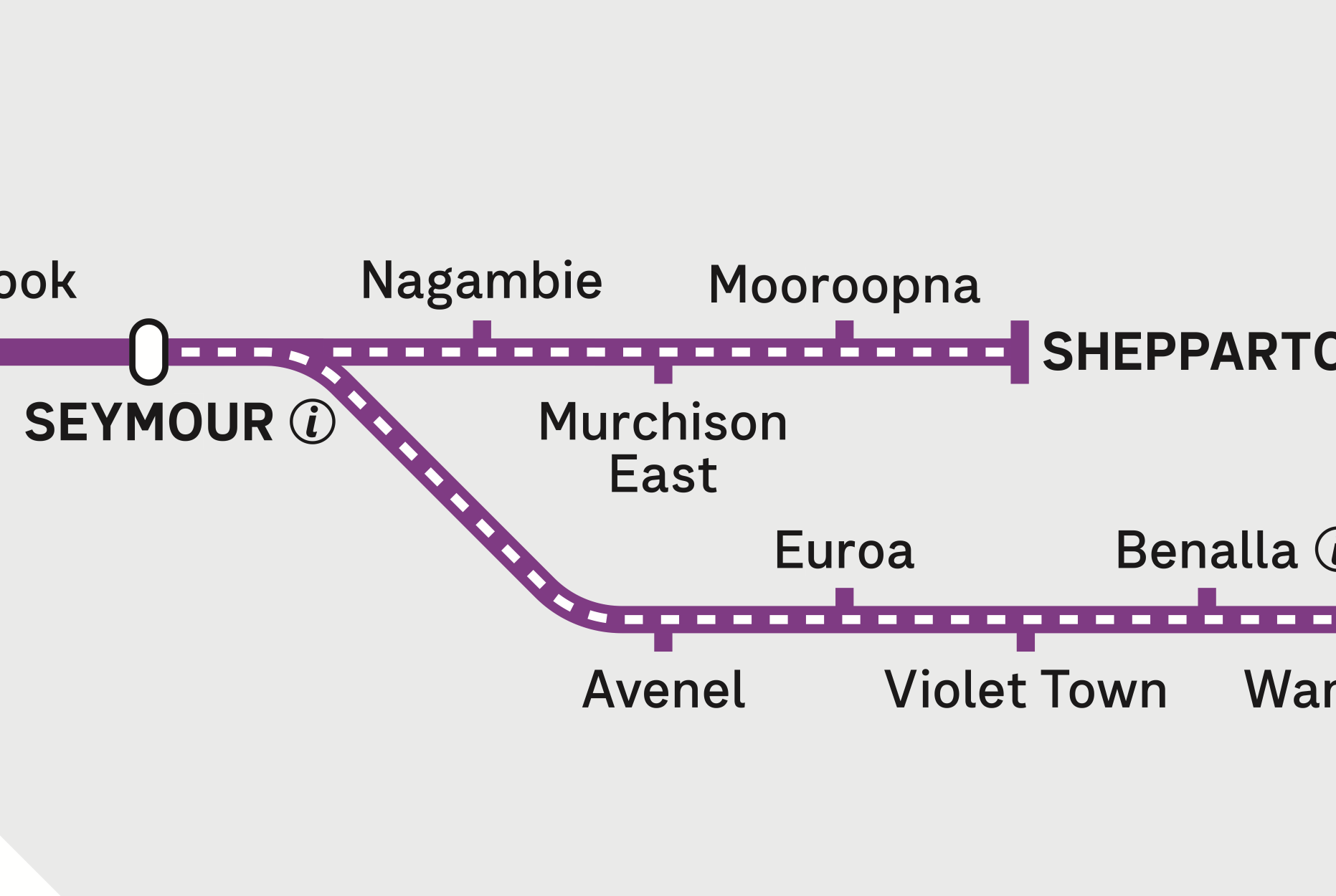
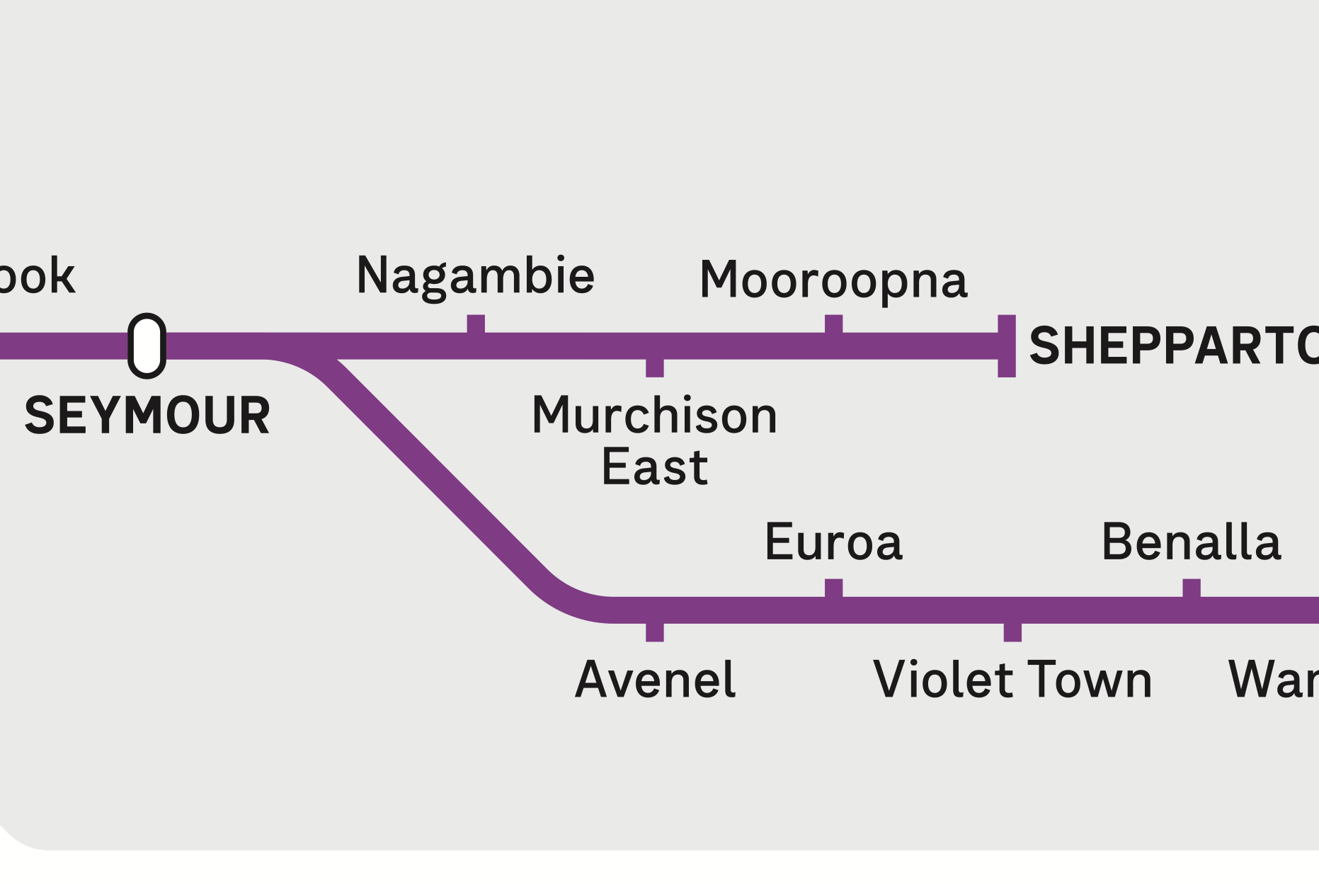
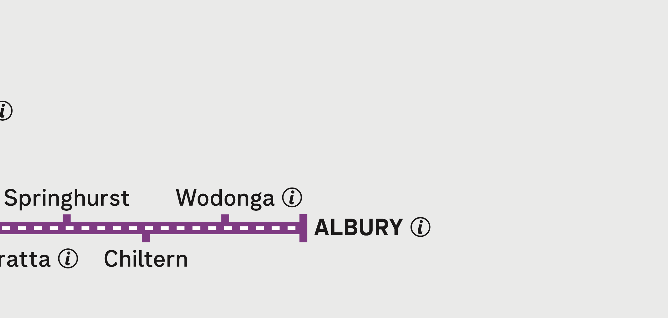
The challenge: The Myki zone stopping short of the Victorian Train Network boundary means hatched lines are used to show where paper tickets are required. This adds additional information that passengers need, compared to tap-on-tap-off travel within most of the state.
Sydney
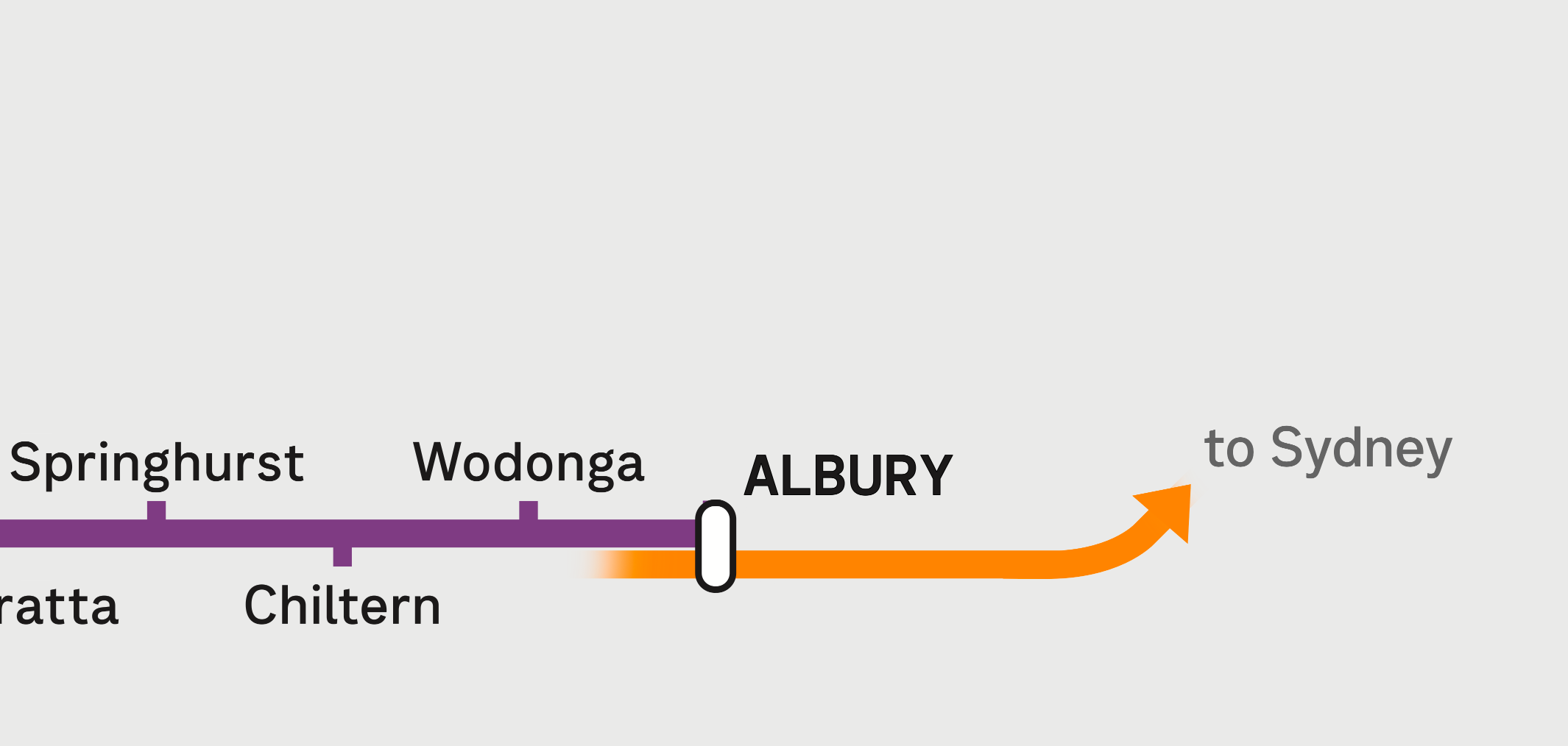
The challenge: Services to Sydney are not run by Transport Victoria and do not use Myki or contactless payment for travel, so there may be a reluctance to show this on the map. This service also shares tracks with freight lines not clearly shown on the map, a trait which it shares with the Albury Line which is also misrepresented on the map. However, SkyBus services to the airport are also operated by a private company, and also requires separately purchased tickets, and that is shown on the map.
Adelaide

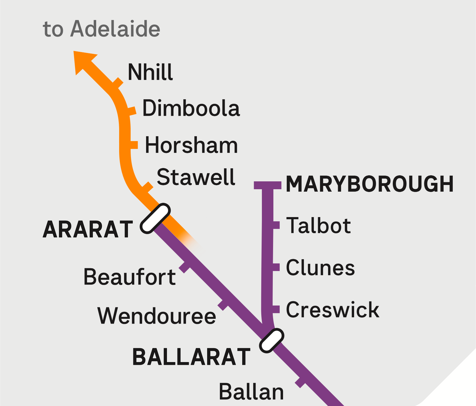
The challenge: Services to Adelaide are not run by Transport Victoria and do not use Myki or contactless payment for travel, so there may be a reluctance to show this on the map. This service uses a path not shown on the map, as it shares freight lines via Geelong and Ararat, before continuing to Adelaide.
Legend
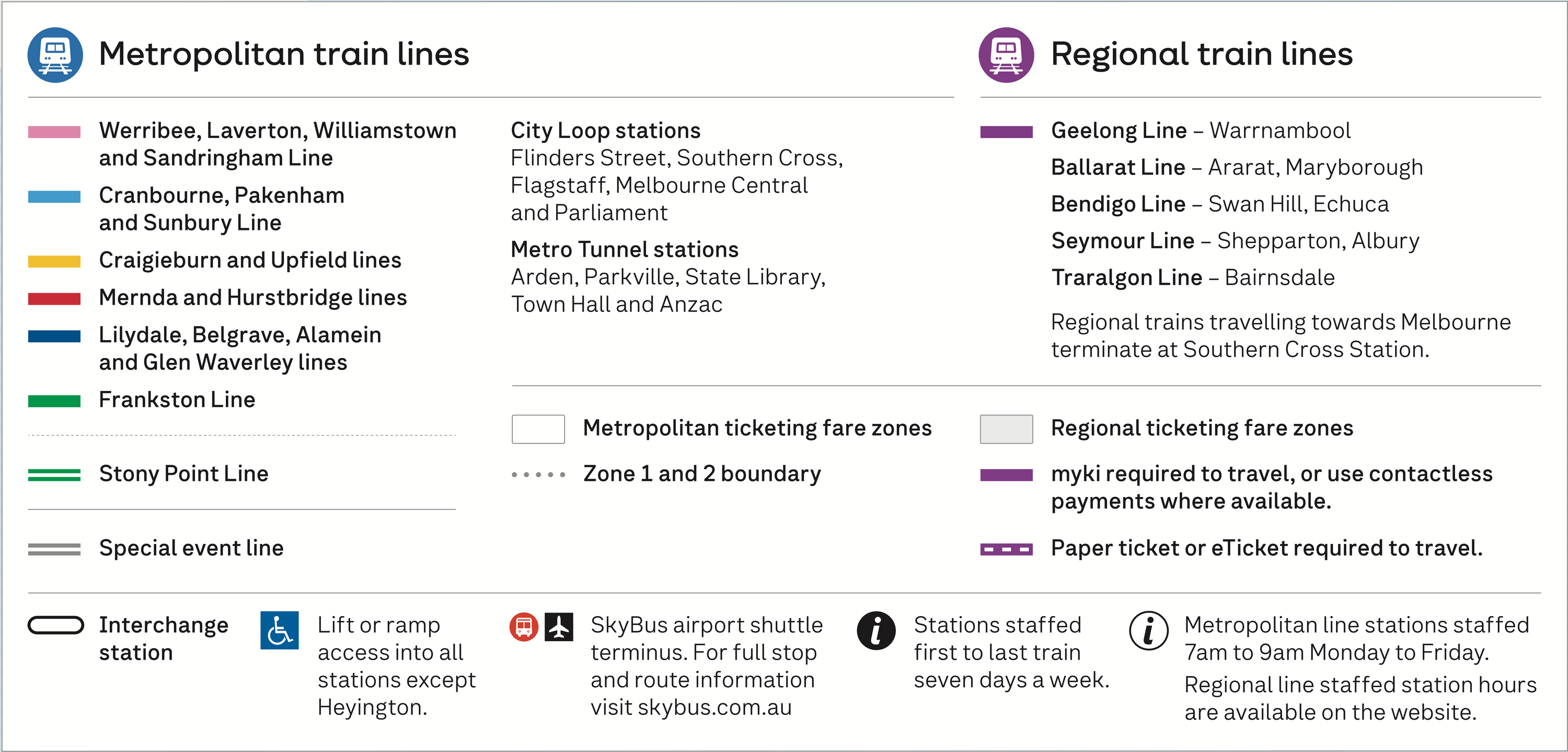
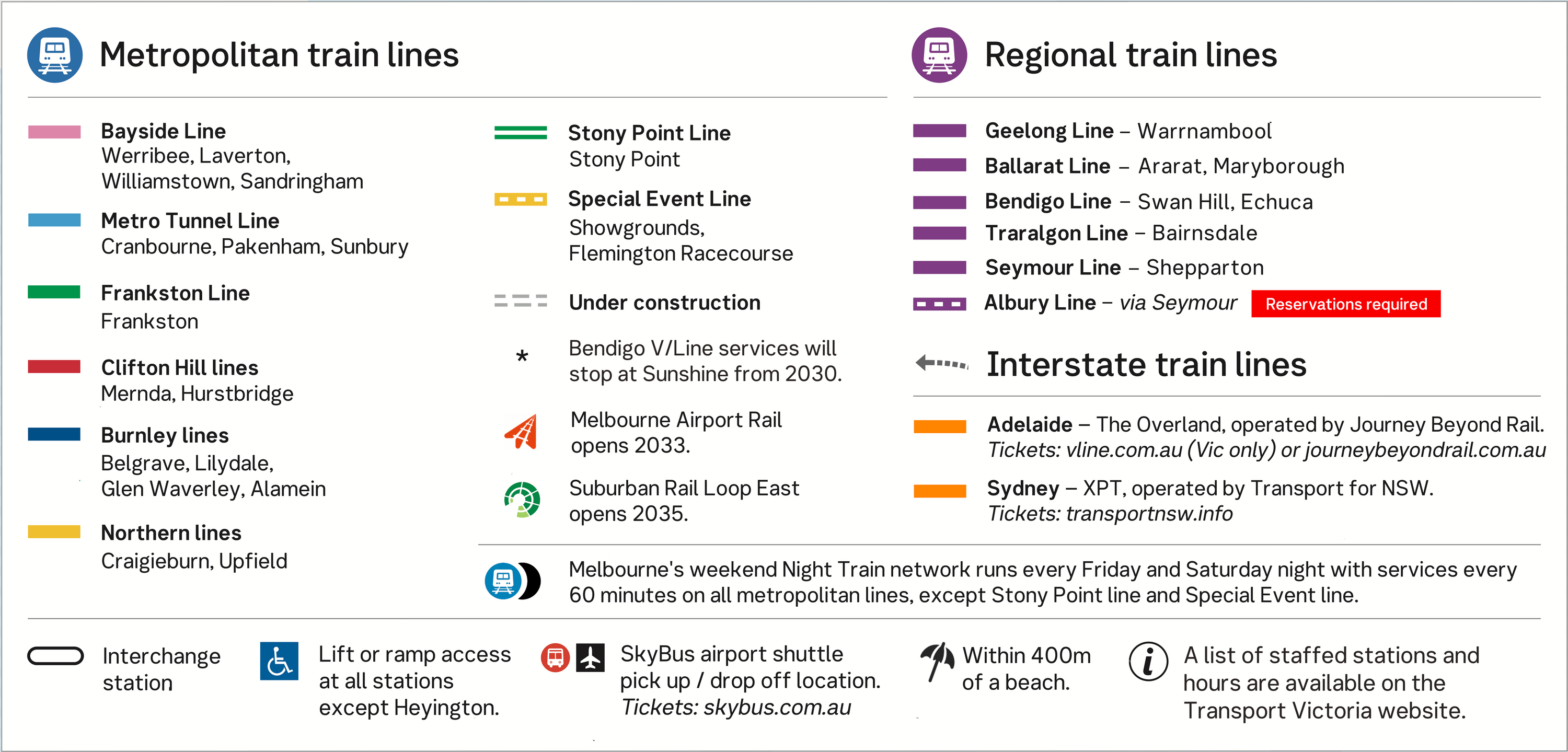
The challenge: Cross city lines have unwieldy names such as the "Werribee, Laverton, Williamstown and Werribee Line" or the "Cranbourne, Pakenham and Sunbury Line". This makes signage and announcements unnecessarily long, compared to cities that use names or numbers for metro lines.
2035+
Updated map showing future projects expected after 2035, including Melbourne Airport Rail, Melton Electrification, and Suburban Rail Loop East. Station names for SRL East are not final. SRL placeholder names as of 2026 are Cheltenham and Burwood instead of Southland and Deakin. Final names not yet decided.
Proposed map by Jeremy Burge, based on official map © Department Transport and Planning. Shows network as expected circa 2035+. View high resolution PNG.
About Better Map for Melbourne
Better Map for Melbourne is not endorsed by or affiliated with the Victorian Department of Transport and Planning. Alternative maps are provided for clarity, critique and comment.
Melbourne's Train Map has undergone significant changes in recent years with the opening of the new Metro Tunnel.
In the coming years, the Sunshine Superhub project will open new platforms for V/line trains from Bendigo to stop at Sunshine station, Melbourne Airport Rail project will deliver trains to Keilor East and Melbourne Tullamarine Airport, and the Suburban Rail Loop east will allow rail journeys from Southland in Cheltenham, to Clayton, Monash University, Glen Waverley, Deakin University, and Box Hill.
Electrification of services to Melton will also provide direct access to the Metro Tunnel for passengers in Melton, Cobblebank, Rockbank, Caroline Springs, Deer Park, and Ardeer for the first time.
The alternative map shown at Better Map for Melbourne aims to improve the way that existing information is displayed, and provide a look at how future services could, or should, be displayed. Contactless Travel Zone, Myki Zone, and Regional Fare Zone, and Paper Ticket Zone currently simplified pending further updates to the Next Generation Myki rollout throughout 2026-2027. More about contactless travel and Express Transit Mode.